Home › Forums › Ride Reports › 2008 Rally – a bit of an adventure
-
AuthorPosts
-
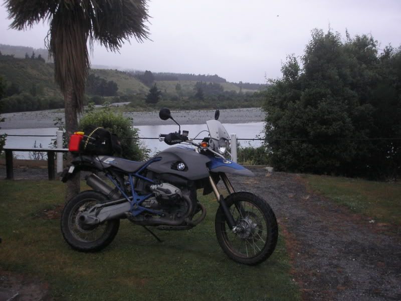
Great trip down to the rally this year. I set off on Thursday 3 Jan on the early ferry with a plan to catch up with Ross Williams (Marlborough Area rep) and head down to Geraldine for the night there. As it happens I missed him in Blenheim (and in Kaikoura) and ended up diverting to Christchurch to stay the night there instead due to some trouble with my ears, but let’s not get into that. I gave Ross a ring and let him know I’d meet him for breakfast the next day. Left Christchurch on Friday morning about 6:00 am. It was overcast but quite warm, although I got into a fair bit of patchy fog and drizzle on the run through Hororata. The temperature must have dipped by about 10 degrees dropping down into the Rakaia Gorge, so a quick stop to throw on my Comfortemp™ gear was in order.
 Duly caught up with Ross and, after a great breakfast at the Bakery, we headed West for a short distance to find gravel South. On the way through here you find Waitohi and, as you do, there’s a compulsory stop for a photo at the Pearce Memorial.Richard "Bamboo Dick" Pearse, was a self-taught inventor, prophetic designer, trail blazing aviator and eccentric visionary. On or about 31 March 1903 this reclusive New Zealand farmer climbed into a self-built monoplane and flew for about 140 metres before crashing into a gorse hedge on his property. There has always been some uncertainty about whether this met the definitions of sustained flight, but it came eight months before the Wright Brothers entered the record books at Kitty Hawk, North Carolina on 17 December 1903.
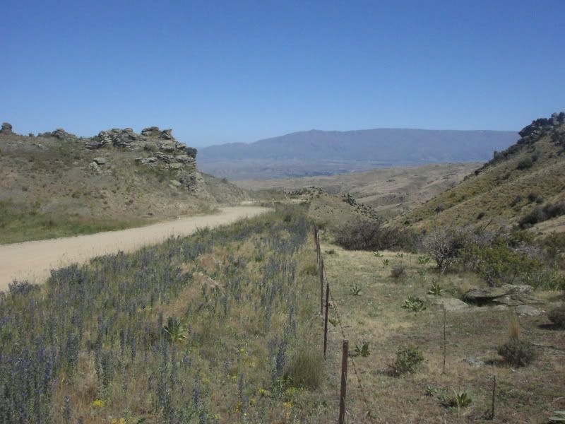
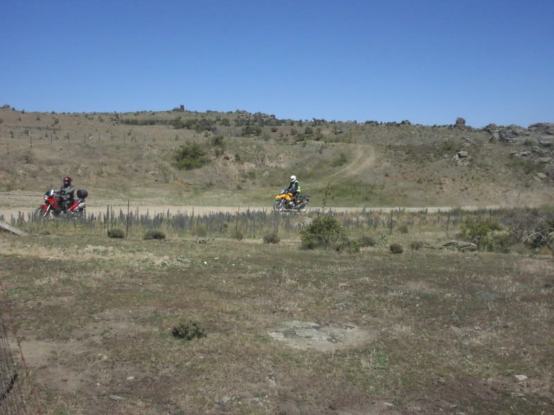
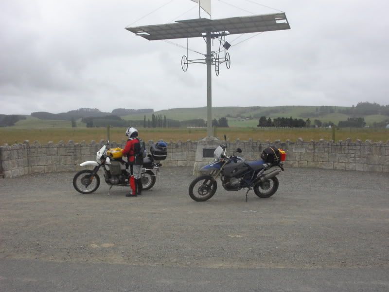 From there, it was a very quick run on a combination of great sealed and single back roads through the Rangitira Valley to Pleasant Point. A right-hand turn and a run up SH 8 toward Albury finds you at the turnoff to the Camp and Limestone Valleys. Gorgeous roads through here and in no time we were at Mackenzies Pass, which crosses the Dalgety Range. The Pass is not a difficult ride but with very low cloud and a drizzle that was not wet enough to dampen the dust down (but just enough to stick to your visor) it was annoying not to be able to see anything more than a foot in front of you. However, that didn’t last long and before we knew it we’d come out on Haldon Road and glorious sunshine. A short burst left and we’re then on the Hakataramea Pass Road. This is a great road of about 100 kilometres in distance, a handful of easy fords and sheep that tend to blend in with the terrain, i.e you don't see them until they move and that's usually right in front of you. The road runs parallel to the Hakataramea River, noted for its brown trout fly fishing. In the 1860's the New Zealand and Australian Land Company leased most of the valley from the Crown. Settlers began free holding from about 1878 and settlement of Hakataramea itself flourished when the Kurow bridges opened in 1881.We stopped in Kurow for gas and a coffee. The HP had covered 183 kilometres since Geraldine and I’d gone through 10 of the 13 litres available in the tank. Richard Cullingworth arrived a few minutes later with his R1100S on his way down to the rally, so we stayed for a bit of a chat.From Kurow we headed East to Duntroon where you turn off to head into Danseys Pass. Danseys Pass was named after William Dansey, who leased the Otekaieke run in North Otago until 1871. He used the route to enter and explore the Maniototo.The road was in great nick and Ross was having some fun on the corners, as his bike was running one cylinder at a great amount of revs. We’d sort that out later.We made it to the Danseys Pass hotel with no further drama, and lo and behold, Gerard and Kathy, Malcolm and Sue, Brent and a few others were enjoying refreshments. Would have been rude not to join them.
 Edwin George built the Danseys Pass Hotel in 1862, and apparently the stonework was pretty much paid for in beer. The hotel served the local miners working the Upper Kyeburn River. Mrs George provided baking for the miners in the Mt Buster workings high up near Mt Kyeburn, riding a horse to the diggings to deliver the bread. She also acted as the local midwife. The goldfields are long gone along with the miners from many countries, who planted the massive tree representing their homeland in the German Creek Reserve behind the hotel.We were just getting ready to go and Helgun and Anja turned up on their 650 Dakars heading North. They'd been looking for us at the rally, a day early though.
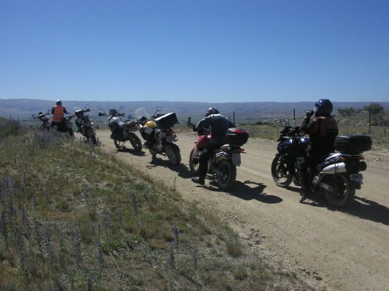
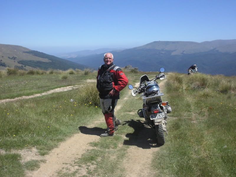
 The last of the gravel out to Naseby, during which we saw the only Policeman on the trip, bought us to SH 85. A rapid squirt along the seal (because the only cop is in Danseys 8-)) to Alexandra followed where we found our lodgings, registered for the rally, cleaned up a bit and headed out to the Stadium tavern for a few cleansing ales and a bite to eat.Saturday turned out hot, very hot! Gavin (a fellow GSer from the UK) and I shot downtown for breakfast and got back in time to have a go at the Gymkana. Was all good fun on the HP, I had another go at the course on Alan’s 1200 GS Adventure so he could take pictures, but neither run proved to be the winning combination of speed and agility. We had a plan to get going on a decent gravel ride, so 12 bikes headed off for a run around the Raggedy Range and over to St Bathans for lunch. The route took us out of Alexandra through Moa Creek and across the flats to Poolburn.
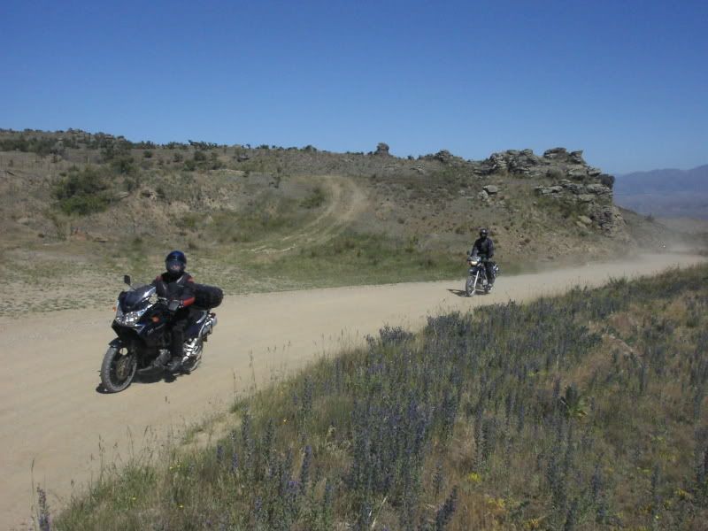
 No Drama, everyone made it to lunch.
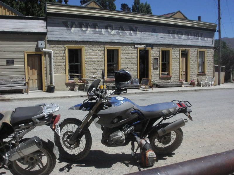 Stephen and I even enjoyed a swim in the Blue Lake. St Bathans originally lay in a small gully. After a decade of mining, Kildare Hill, which enclosed the town on one side, had been flattened and by 1936, as a result of extensive hydraulic mining, there was the lake. The lake bottom is about 40 metres below the town's main street and was filled with mineral enriched water. This is what gives the lake its blue appearance.
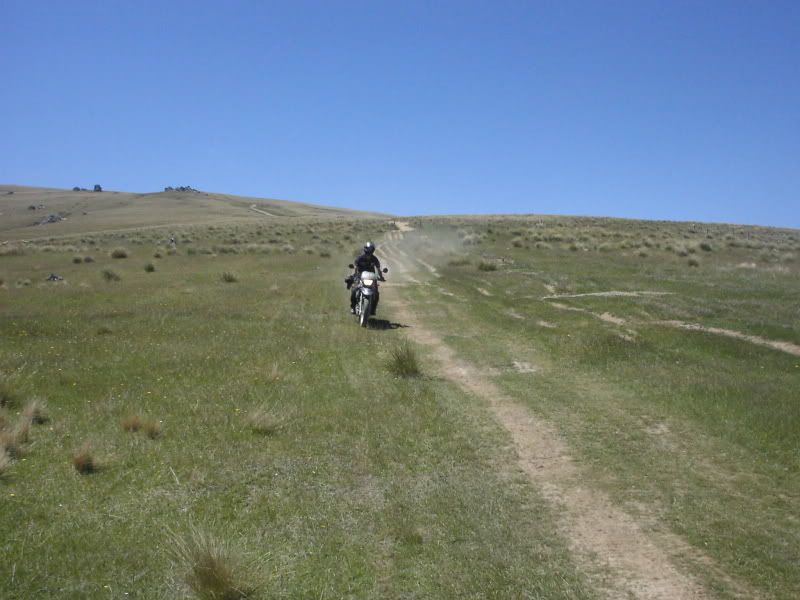
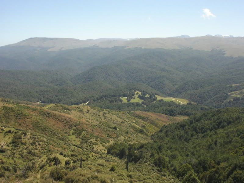
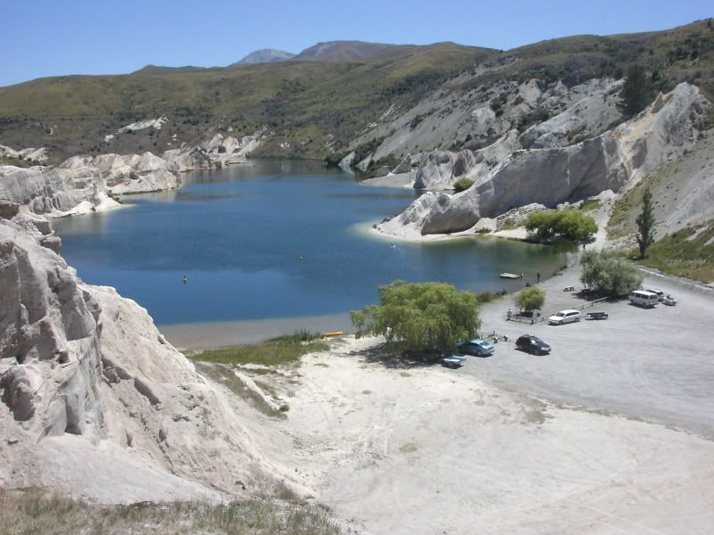 Enough lounging around, we got back into it with a short run through Cambrians to Drybed and found the Rise and Shine Road just before you get to Matakanui. The old Vincent County Council formed this dry weather road back in 1975, which initially followed an early track over the mountain and a stock route of the early 1900s. Along close to the road, in the bottom of a gully, you can see an abandoned crushing battery, the Come-In-Time battery, which still looks in reasonable order considering being abandoned in 1920. The Thomson Gorge Road takes an easy climb to 900m to the saddle on the Dunstan Mountains. The view from 1100m down to Omakau takes in the Manuherikia Valley and the eastern mountain ranges of Central Otago and is absolutely stunning.
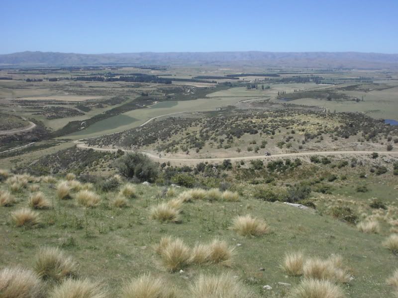
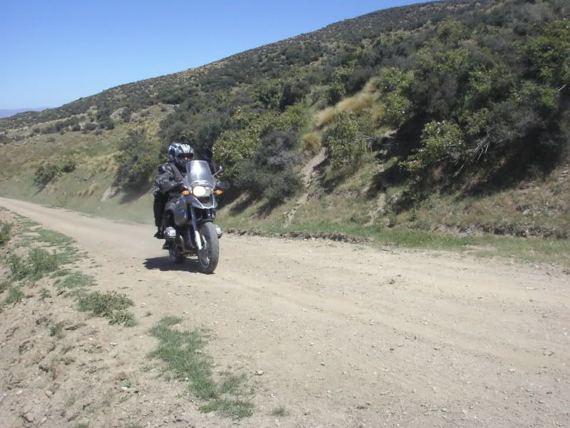
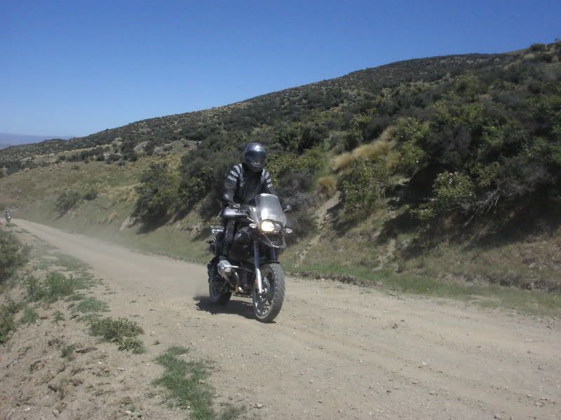
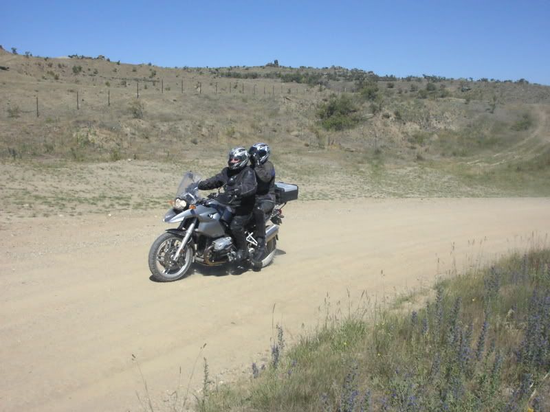
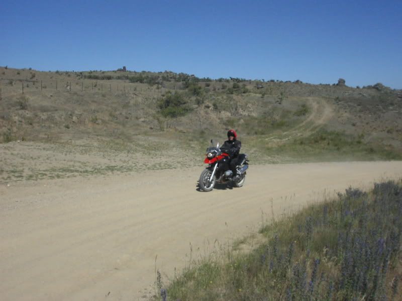
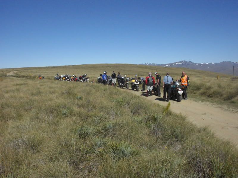
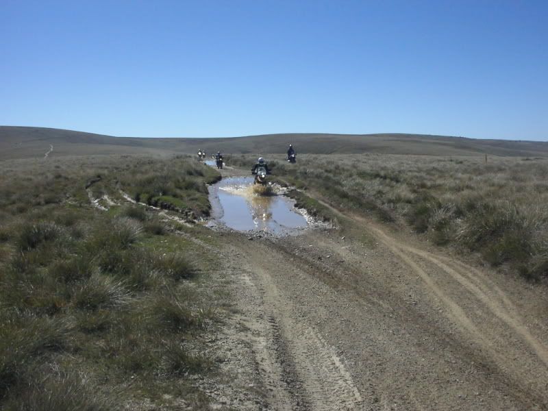
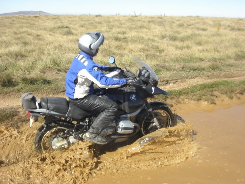
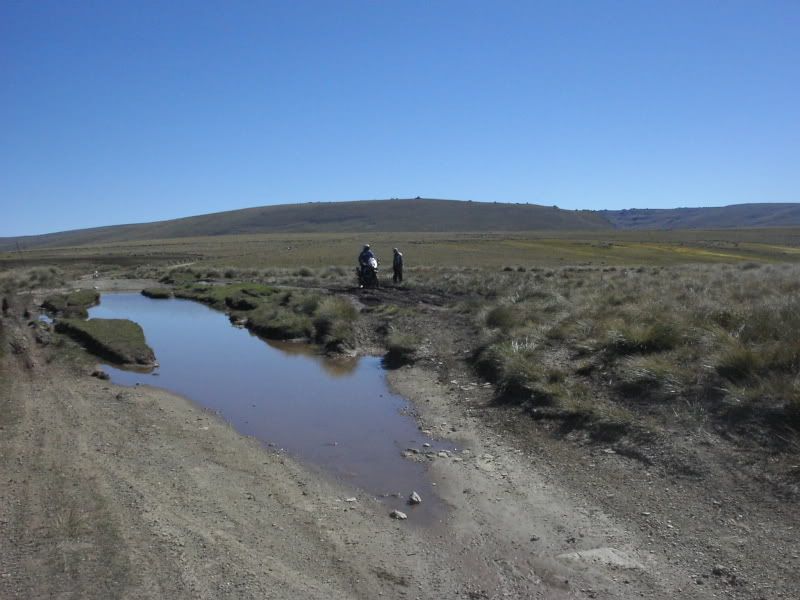
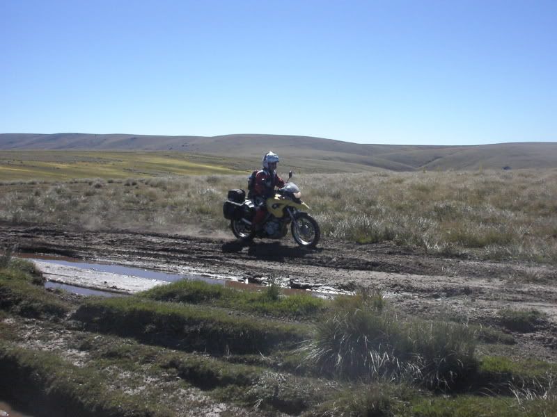
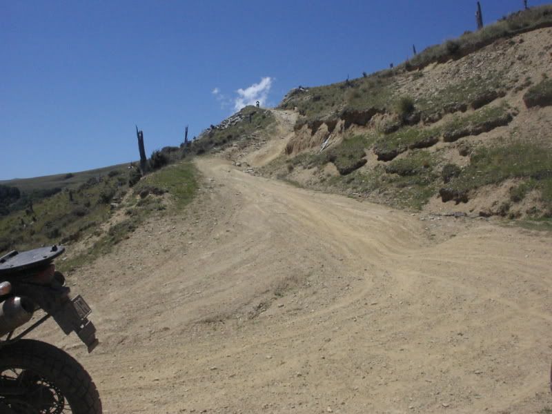
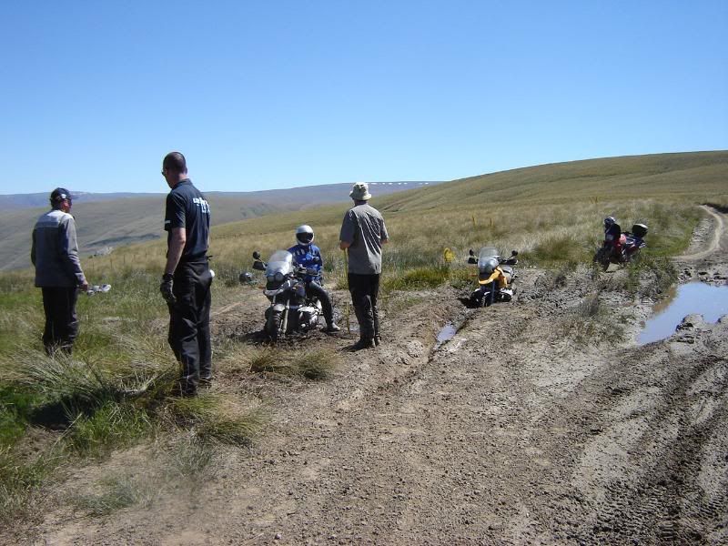
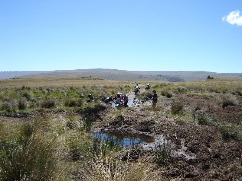
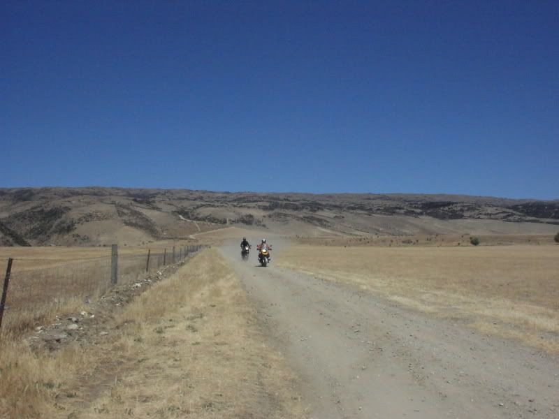 We came off the Dunstan Ranges just South of Tarras and hit the seal on SH 85 back to Cromwell and over to Bannockburn for a well-earned beer at the pub. Just as well we refreshed a bit, the last part of the day was the Earnsleugh track from Bannockburn down into Clyde. I’d forgotten just how steep and rutted the descent could be after a wet winter.Back to Alexandra and the HQ for a shower before a great rally dinner, some tall stories and bed just after 10:00, it’s going to be a bigger day tomorrow than we thought 😮Sunday, and it’s really hot again! It was 35 degrees yesterday and was going to be about the same again today by the feel of it first thing. Henry put on an excellent BBQ breakfast and the bikes were lined up for the Concourse D'elegance, of which he was judging during the course of breakfast. I entered the HP2 of course, but I missed the ‘elegance’ part of the whole thing I think 😛 We waited briefly while the obligatory Annual Rally photo was taken. We hung on for a special photo of the GS crew as well. We left the site at 9:00 in a group of 13 bikes for what I thought was going to be a gentle trip through the Nevis Valley and a jaunt back up over the Crown Range for a relaxing Sunday afternoon.Brent, who was leading the ride, thought we might have a go over the Old Man Range as a warm up for the Nevis later on in the afternoon. The Old Man Range forms the southwestern boundary of the Manuherikia Basin. It’s named after a prominent skyline schist tor at 1,695m, and extends 50km from the Fraser River in the north to the Umbrella Mountains in the south. We entered at Shingle Creek and the plan was to be through to Piano Flat and down into Walkaia for a drink and a bite to eat before coming back over the Nevis. I wasn’t grumbling, as I‘d been over that way a couple of times during previous BMW Safaris, and there were enough of us that any sticky bits wouldn’t be too much of a problem if we all chipped in. As it happens, it took us about 7 hours to do the 100 kilometres or so to Waikaia, so we missed out on the Nevis, sadly. However, a credit to all that travelled the route and for the most part, kept their heads. It wasn’t easy with bogs up to your ears, very steep shingle downhill bits, bits of schist sticking out at all angles and ruts that’d swallow a Landrover in some places. Gavin and Ivan (a mad Irish bugger on a KTM) worked their butts off riding other bikes up and down the hardest bits. Justin was able to pillion Vicki out of the worst of it. Everyone pitched in to drag bikes out of bogs and water holes, and there was some of the best riding to be had that any adventurer could wish for. It was hard work, but I had an absolute blast. The photos following sort of sum it all up really.
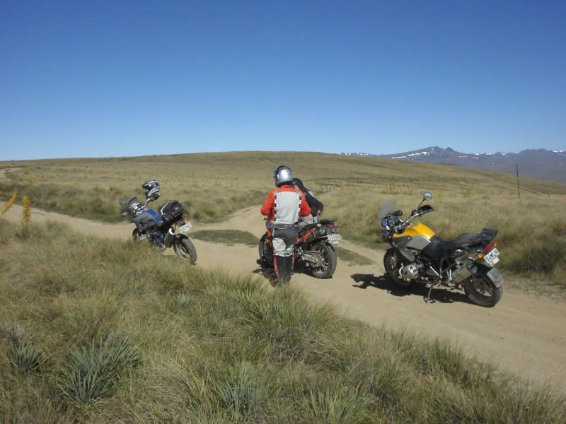
 Anyhow, we all got out safely and with many stories to tell. We elected to stick to the seal down to Gore (I needed gas by this stage) and take a run straight back up to Alexandra to the Stadium Tavern for another dinner. Those first couple of beers didn’t even touch the sides.Monday came up way too quick, a lot cooler than the last couple. Justin and Brent were heading toward Christchurch and I to Temuka to visit friends. Ross needed to be back in Blenheim that evening so he took a couple of others up through the Lindis. We said our goodbyes to everyone else and headed off to take on Danseys Pass in reverse. It’s quite a different ride going back the other way, but just as enjoyable. Brent said goodbye to us at Kurow and headed off for Waimate. Justin and I traversed the Hakataramea Road and Mackenzie Pass Road, again delightful in reverse and quite different. There's some big open spaces through there and we saw no other vehicles on the whole trip.
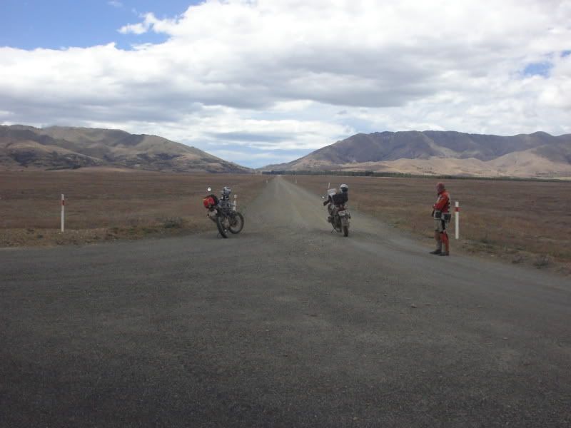 At Albury, Justin turned left and headed for Fairlie, I turned right and headed to Temuka. I stayed the night in Christchurch and Tuesday morning turned out pretty average. I headed up the coast and decided to take the inland route through to Culverden, where it started raining. After a couple of days of 30+ temperatures it felt very cold and I put the linings back in my jacket and trousers. I stopped for food and coffee at Waiau and took an easy run up through Mt. Lyford and on to Kaikoura. Met up with Warwick and Vicki at the Gas station, they were heading for the 2:30 ferry sailing so needed to get a wriggle on.I had plenty of time as I wasn't sailing until 6:00 pm so scooted up to Seddon and turned down into the Awatere Valley to take a look over Taylors Pass Road down into Blenheim just for the hell of it.
  I stopped in Blenheim for a cuppa with Ross (who’d got back the day before in time for work) and made it well in time for the 6:00 sailing. Mine was the only bike on the ferry so I had my pick of the new tie-downs the Awatere is now carrying for motorcyclists and meant I didn’t have to go to the trouble of unpacking mine. Nice!!All of a sudden I found myself back in the land of buildings and cars and cops and it was raining. I was thinking about turning around and just getting lost again, but then Jo would be upset that I hadn’t called home first. Must say it was nice to be home in my own bed again though.Still got a big smile on, jut finished washing a couple of ton of dirt off the HP. Jo and I and our friends John and Linda get to go and do the whole South Island thing again for two weeks in March. I can’t wait 😀
Thanks for writing all that up Garry. I'll add some photos once we get back. I am typing this from Te Anau. Tomorrow we'll ride out to Milford sound.
Anonymous
Inactive09/01/2008 at 5:13 amPost count: 305Well done Alex!Usually it's only the "Crusty Demons" that get their bikes inverted!We always knew you were a stunt rider!
Good RR Gary and I also enjoyed the Rally rides, Aslan and I took a different route down (Black Forest Station instead of Haka Valley) and we also put our bikes on the Earnslaw and went down the road from Walter Peak Station past Lake(s) Mavora. 😀 😀 😀A Great time was had.CheersIan
a top report Garry – really enjoy our comments about the significant items of interest about a particular location – no wonder you're the editor of the magazine 🙂 – top rides at the rally also – cheers Aslan aka Stephen O 🙂
Guest09/01/2008 at 8:56 amPost count: 2134Well done Alex!Usually it's only the "Crusty Demons" that get their bikes inverted!We always knew you were a stunt rider!
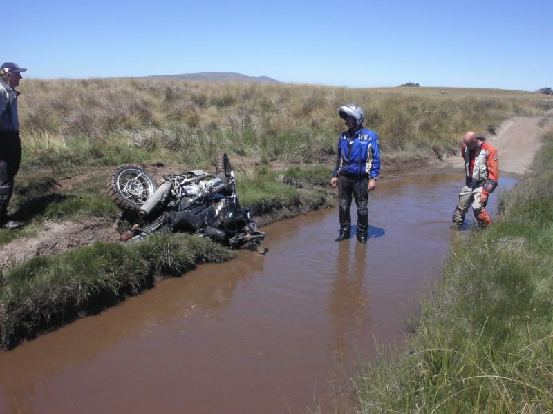
It looks like they are waiting for the bike to stand up by it self. That is the best shot I have seen of a GS wrong side up :-D. Alex did you scrape the pegs 😎
Well done Alex!Usually it's only the "Crusty Demons" that get their bikes inverted!We always knew you were a stunt rider!
It looks like they are waiting for the bike to stand up by it self. That is the best shot I have seen of a GS wrong side up :-D. Alex did you scrape the pegs 😎
I didn't scrape them on this ride Dean, only the tank and the windscreen. The bike fell over on the wrong side. I was up front and picked the wrong line. The track was difficult during the steep sections, but this was made worse from the exhaustionj and lack of water. We had to shuffle two bikes along, that amounted to a lot of walking back to get the other bike.
Gary why have I got a smile on my face and it was there all day , what a great days riding, no worries, we must do it again soon. Cheers Ross 😀
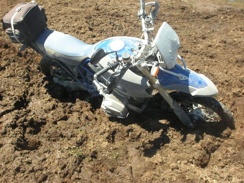
Here are some of our photos from the old man crossing. For us it was quite an adventure, I was pretty exhausted by the end. Some of our photos are below. If anyone has the shot of my bike in the puddle, I'd love to have a copy of it.


nice pics Alex – yours show the challenge of descending the Old Man Range better than my pics especially the slabs of schist.feel free to move my posts into this thread if you feel this is a more apprpriate thread - cheers S
We have a number of threads on the same topic all over the place. It's a bit messy, but it shows that the event was exciting and offered a range of opportunities. I wonder if we should remove the rally and event section altogether and just keep everything under ride reports. Feedback would be appreciated.I'll leave everything for now, but may tidy it up later (If I can) once the excitement has cooled off. Having reports like these are a real boost for the forum and the register. It shows that we are a diverse group of active people and that it is worthwhile to join the register.
-
AuthorPosts
- You must be logged in to reply to this topic.